|
|||
Suggested Flies for Goddard Creek area: | Dry Flies: |
Nymph Flies: |
|
|
Directions: 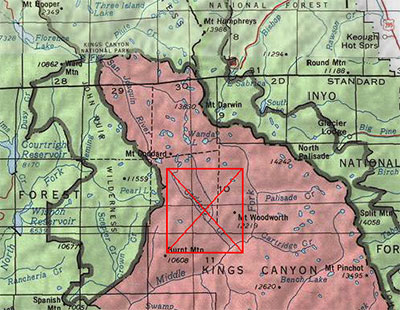
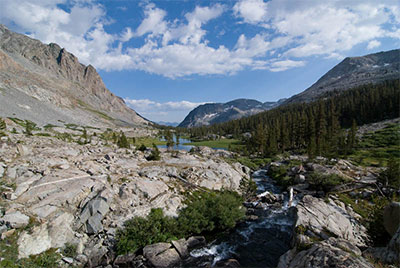
I put this region within the East Side maps due to proximity, not to ease of access.The preferred route is often from the West Side, taking the ferry across Florence Lake. It is a 7.5 mile hike to the Kings Canyon Nat. Park boundary with a possible stop at the Muir Trail Ranch and a dip within the hot spring. The end of the trail in Goddard Canyon is 14.25 miles from the ferry dropoff at Florence Lake. An alternative route from the west side is through Hell For Sure Pass from the Courtright Trailhead. It is about a 20 mile hike to Goddard Canyon. The Goddard Canyon trail ends near Martha Lake. Go off trail past Martha and proceed over Reinstein Pass into the headwaters of Goddard Creek. | ||
|
| ||
|
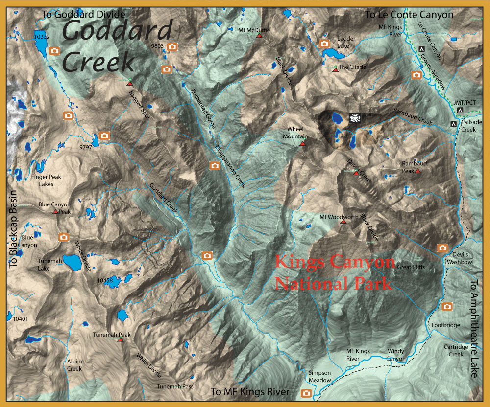
Notes: Goddard Creek: The best fishing on Goddard Creek is above the confluence with Tunemah Creek. Below the confluence, Goddard Creek becomes quite steep and the creek rushes downward into a series of plunge pools to the MF Kings river. There is fishable water around the confluence of Disappearing Creek for a mile downstream but no reports of fish. The creek then becomes a very steep gradient just prior to reaching the MF Kings. Lake 9797: Plenty of Rainbows 10-11" Finger Peak Lakes: The lower lakes below 10,300 most likely have Rainbows but not confirmed. Blue Canyon Lakes: The lakes above 10,300' are fishless. The lakes below have Rainbows 10-11" Tunemah Lake: Tunemah has had reports of large rainbows up to 18". Lakes below Tunemah also have Rainbows 12-14". Middle Fork Kings River: Through Le Conte Canyon and below Grouse Meadows, this water contains Golden Hybrids 4-7 inches. Some up to 11" within the deeper pools of the pocket water between the meadows. Downstream of the confluence of Palisade Creek, the Middle Fork has a steep gradient and is unfishable passing through a narrow canyon until it reaches the confluence of Cartridge Creek. Below Cartridge Creek confluence into Simpson Meadow, the Middle Fork Kings has Rainbows and Brookies. Ladder Lake: (Elev 10491) No confirmed reports but Cutter indicates that Rainbows are present.
| ||
Fishing Regulations (Effective March 1st, 2021)Lakes within Goddard Creek: Open all year. No restrictions. 5 trout per day. 10 trout in possession Middle Fork Kings River: From the last Saturday in April through November 15, five trout daily bag limit, 10 trout in possession; and, from November 16 through the Friday preceding the last Saturday in April, 0 trout bag limit, artificial lures with barbless hooks only and trout must be released unharmed and not removed from the water. All creeks and tributaries: From the last Saturday in April through November 15, five trout daily bag limit, 10 trout in possession; and, from November 16 through the Friday preceding the last Saturday in April, 0 trout bag limit, artificial lures with barbless hooks only and trout must be released unharmed and not removed from the water. | ||