 Click the map or the link for a detailed map of the area: |
||||
|
8. Hope Valley |
||||
|
| |||
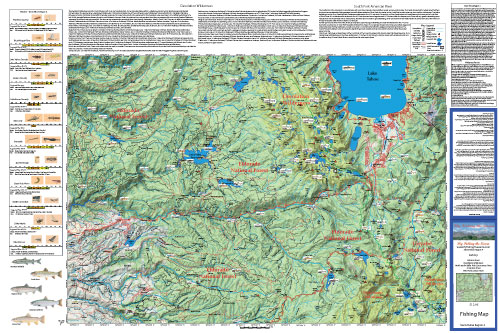
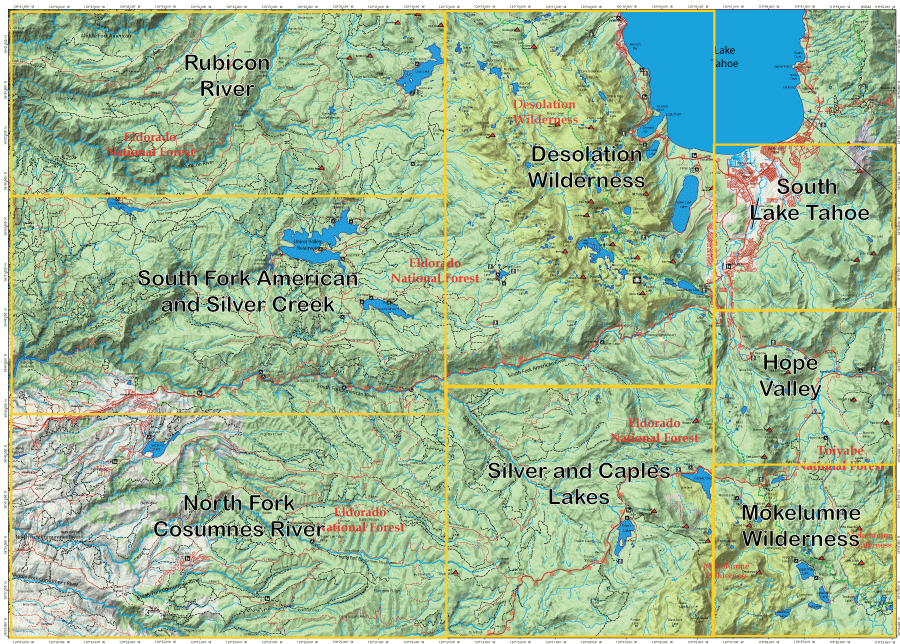
Fishing Map AvailableCovers Rubicon River, Desolation Wilderness, South Lake Tahoe, South Fork American, Silver Creek, Truckee River, North Fork Consumnes River, Silver Lake, Hope Valley, and Mokelumne Wilderness. Shows topographic relief, GPS Long./Lat., camping areas, road access, and trailheads. Special Features are Fishing Season and Regulations, Hatch Chart, Fish Identification, and Stream Etiquette guidelines. |
Sierra Tahoe Region 4
|
$12.95 each |
|