|
Directions: 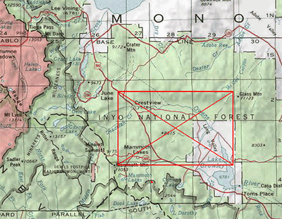
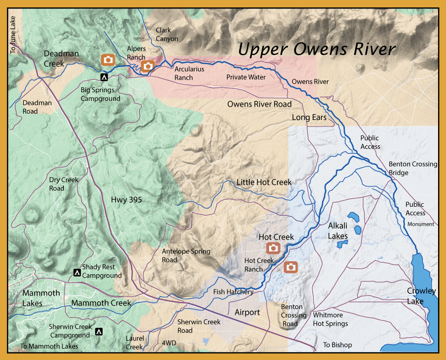
The Upper Owens River can be reached from Hwy 395 by way of Benton Crossing Road or from the Owens River Road, 7 miles north of Mammoth Lakes. The Upper Owens River consists of 15 miles of "Spring Creek" type of water flowing from it's headwaters at Big Springs and emptying into Lake Crowley. There are three ranches with private waters that start about a mile below Big Springs and extend about 4 miles to Long Ears. Access to Long Ears is about 5 miles downstream from Big Springs, turning left on a dirt road past the cattle guard. The Benton Crossing access has numerous dirt roads covering about 10 miles of the lower reaches to the river mouth. Hot Creek can be reached by taking Hot Creek Road directly off Hwy 395 next to the Mammoth Airport. Access at upper parking lot as well as the parking lot above the hot springs. | ||
|
Fishing Report: Upper Owens Flow Report: Upper Owens
| ||
|
Notes:
| ||
Fishing Regulations (Effective March 1st, 2021)Deadman Creek downstream from Hwy 395 to Big Springs.: Open all year. 0 trout. Only artificial lures with barbless hooks. Creek is often dry just above Big Springs. Upper Owens River from Benton Bridge road crossing upstream to Big Springs.: Open all year. 0 trout. Only artificial lures with barbless hooks. Upper Owens River from Benton Bridge crossing to Crowley Lake: Last Saturday in April through July 31st. No restrictions, 5 trout. Hot Creek (Mono Co.). Hot Creek from the State hatchery property line to the confluence with the Owens River.: All year. Only artificial flies with barbless hooks may be used. 0 trout. All other creeks and tributaries: From the last Saturday in April through November 15, five trout daily bag limit, 10 trout in possession; and, from November 16 through the Friday preceding the last Saturday in April, 0 trout bag limit, artificial lures with barbless hooks only and trout must be released unharmed and not removed from the water.
| ||
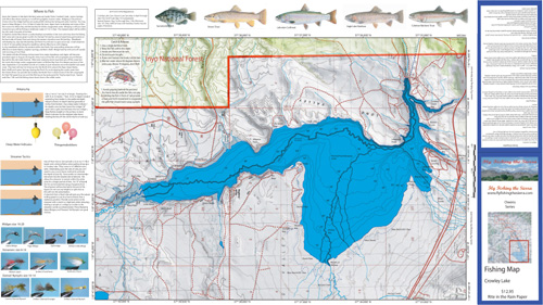
Fishing Map AvailableCovers the water of Lake Crowley. Shows lake topography, GPS Long./Lat., camping areas, road access, and below-surface stream channels. Special Features are Suggested Flies, Midging Rigs, Streamer Tactics, Fishing Season and Regulations, Fish Identification, Where to Fish, Catch & Release Procedures, and Stream Etiquette guidelines. Printed on Rite-in-the-Rain Paper that will allow you to write those special notes. Waterproof and Durable. |
Lake Crowley
|
$12.95 pkg
|
|
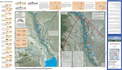
| Covers the Owens River between the mouth of Crowley Lake to Benton Crossing Bridge. Satellite photo background depicts vegetation surrounding the river. Shows camping areas, GPS Long./Lat., road access, trails, and fences. Access through the Stream Fence are shown. Special Features are the Hatch Chart, Fishing Season and Regulations, Fish Identification, Catch & Release Procedures, Nymphing Rigs, Knots, and Stream Etiquette guidelines. Printed on Rite-in-the-Rain Paper that will allow you to write those special notes. Waterproof and Durable. | Upper Owens 1, Lake Crowley to Benton Bridge Crossing
|
$12.95 pkg |
|
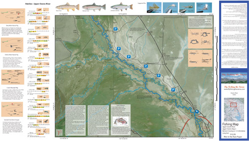
| Covers the Owens River between the Benton Crossing Bridge to 1/2 mile below Long Ears.Satellite photo background depicts vegetation surrounding the river. Shows camping areas, GPS Long./Lat., road access, trails, and fences. Access through the Stream Fence are shown. Special Features are the Hatch Chart, Fishing Season and Regulations, Fish Identification, Catch & Release Procedures, Nymphing Rigs, Knots, and Stream Etiquette guidelines. Printed on Rite-in-the-Rain Paper that will allow you to write those special notes. Waterproof and Durable. | Upper Owens 2, Benton Bridge Crossing to 1/2 mile below Long Ears
|
$12.95 pkgPurchase Here |
|
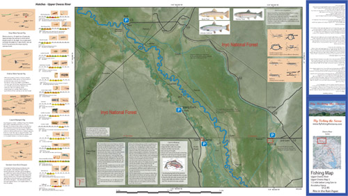
| Covers the Owens River between 1/2 mile below Long Ears to the Arcularius Fence. Satellite photo background depicts vegetation surrounding the river. Shows GPS Long./Lat., road access, trails, and fences. Access through the Stream Fence are shown. Special Features are the Hatch Chart, Fishing Season and Regulations, Fish Identification, Catch & Release Procedures, Nymphing Rigs, Knots, and Stream Etiquette guidelines. Printed on Rite-in-the-Rain Paper that will allow you to write those special notes. Waterproof and Durable. | Upper Owens 3, 1/2 mile below Long Ears to Acularius Fence
|
$12.95 pkg |