 |
||
Suggested Flies for Main Kings: | ||
|
Other Local Favorites: Dry Flies: |
Nymph Flies: |
|
|
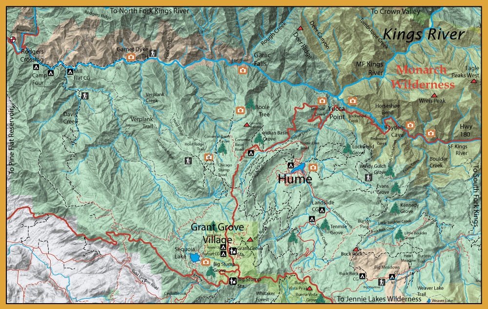
Directions:  The Kings River can be reached from Fresno by way of Hwy 180. Trimmer Springs Road will take you up to the town of Piedra, below Pine Flat Reservoir. Following this road around you can get access to the North Fork of the Kings and also access to the 20 mile long Wild Trout Section above Garnet Dyke on the Main Kings up to Boyden Cave. | ||
|
| ||
|
Notes: Tim Huckaby wrote an excellent blog piece on his experiences within the confluence of Middle Fork and South Fork in October, 2020. Visit his blog: Tim Huckaby.com Hume Lake: (Click the highlight area on map for detail information) 85 acres. It is stocked with
about 32,000 Rainbows each year and have holdovers that get to a good size. Hume Lake Christian Camp plants over 3,700 pounds of
rainbows in the 12-14 inch range and several hundred in the 3-5 Lb. range from the San Joaquin Hatchery. Large resident Browns are also
present. | ||
Fishing Regulations (Effective March 1st, 2021)Kings River, from the confluence of the South and Middle forks downstream to Garnet Dike Campground.: Open all year. Only artificial lures with barbless hooks may be used. 0 trout. Kings River, from Garnet Dike Campground to Pine Flat Reservoir.: Open all year. No restrictions. 2 trout, 4 trout in possession. Middle Fork Kings River inside Kings Canyon National Park: Below 9000' elevation, 0 rainbow trout and 5 trout limit for non-native trout, ie Browns, Brookies. Middle Fork Kings River from the western boundary of Kings Canyon National Park downstream to the main Kings River: Open all year. Only artificial lures with barbless hooks may be used. 0 trout. South Fork Kings River from its confluence with Copper Creek downstream to the Highway 180 crossing at Boyden Cave.: Open all year. No restrictions. 2 trout, 4 trout in possession. Other Rivers and Streams: From the last Saturday in April through November 15, 5 trout daily bag limit, 10 trout in possession; and, from November 16 through the Friday preceding the last Saturday in April, 0 trout bag limit, artificial lures with barbless hooks only and trout must be released unharmed and not removed from the water. Other Lakes within this area: Open all year, 5 trout daily bag limit, 10 trout in possession.
| ||
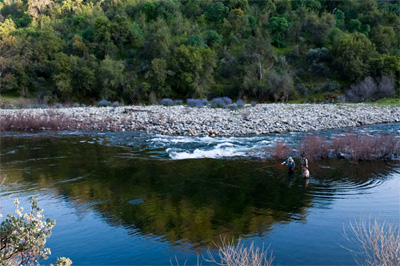
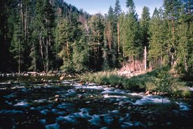 The Kings River above Pine Flat Reservoir is a wild trout only water. All plantings by DFG are below Pine Flat Reservoir. The season is year-round. The section of the Kings above Pine Flat Reservoir, along Trimmer Springs Road up to Garnet Dike Camp is worth investigating. There are a lot of big fish hanging out in the riffles, holes and long tail-outs that are characteristic of the water in this area. This area has a 2- trout limit with no restrictions on tackle. The entire length of 20 miles from Garnet Dike Campground to the confluence of the Middle and South Fork of the Kings is a designated Wild Trout area Catch and Release only with barbless flies. You can follow the riverbank or follow a trail upstream from the campground. The trail will reach a higher elevation above the river making access difficult for about 1 mile. Then it drops down to the river.