|
Directions: 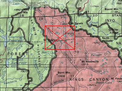
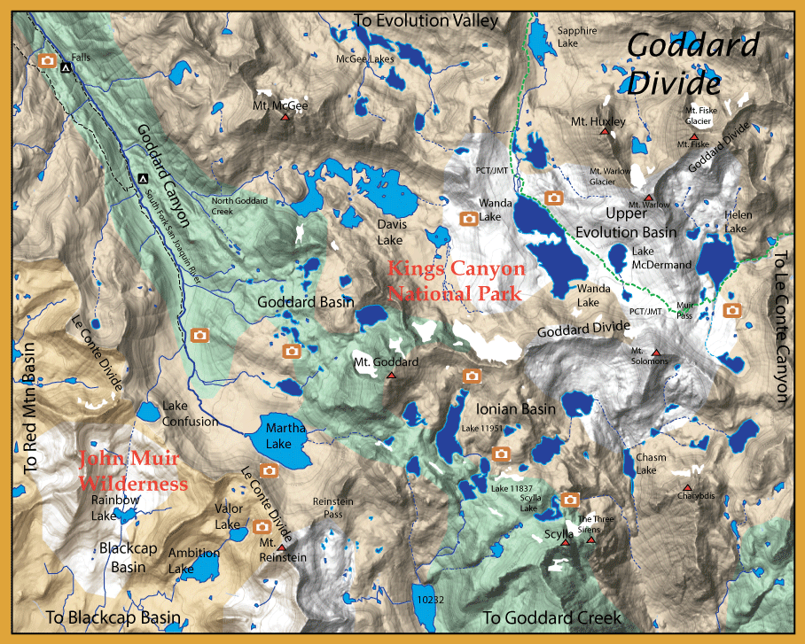
I put this region within the East Side maps due to proximity, not to ease of access.The preferred route is often from the West Side, taking the ferry across Florence Lake. It is a 7.5 mile hike to the Kings Canyon Nat. Park boundary with a possible stop at the Muir Trail Ranch and a dip within the hot spring. The end of the trail in Goddard Canyon is 14.25 miles from the ferry dropoff at Florence Lake. An alternative route from the west side is through Hell For Sure Pass from the Courtright Trailhead. It is about a 20 mile hike to Goddard Canyon. To reach Goddard Creek, go off-trail to Martha Lake and take Reinstein Pass to reach headwaters of Goddard Creek.
From the East Side, there are two traiilheads that will get you to Goddard Canyon. One is by way of North Lake going over Piute Pass (11,500') and passing through Humphries Basin and Piute Canyon. This will bring you onto the PCT north of Goodard Canyon, a distance of about 16 miles. This is also the boundary to Kings Canyon National Park. Following the PCT southward for 3.5 miles will bring you to a fork. The left fork continues on the PCT up to Evolution Meadow, going straight will take you up Goddard Canyon. The trail ends 6.75 miles from the park boundary. A total of 26 miles from the North Lake Trailhead. The second way is to take the South Lake trailhead going over Bishop Pass and dropping into Le Conte Canyon where you pick up the Pacific Crest Trail (PCT), a distance of 11 miles. But you still have to climb over Muir Pass, so you have two 12,000' passes to cross and it is a 17 mile hike until reaching Helen lake on the Goddard Divide. Some will take an overland route from Wanda Lake to Davis Lake and follow North Goddard Creek to the Goddard Canyon trail. The last part of this trek is to reach Martha Lake and go over Reinstein Pass to reach the headwaters of Goddard Creek. |
|
Notes: 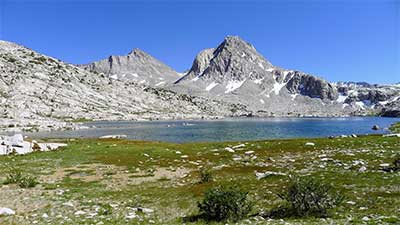
Kings Canyon National Park encompasses this entire area. Prior to 1988, many of the streams and lakes were planted with trout. This practice had some drawbacks to the native biota such as amphibians. After 1988, all fish planting within the park was discontinued. Park streams and lakes were managed for a sustainable fishery. Those streams and lakes that could not support a fishery were allowed to go fishless. However, by 1990, it was evident that certain amphibians such as the Mountain Yellow Legged Frog (MYLF) had not recovered enough and a management plan was implemented to eradicate certain lakes and streams of non-native fish. By 2013, 15 lakes and ponds were eradicated of fish. Over the next 25 years, the Park intends to eradicate another 70 lakes, streams, and marshes to reach a 15% level of fishless habitat. Most of these fish removals are within the higher elevations of the park and many are fishless due to the unsustainability of fish within these waters due to lack of food source, lack of spawning grounds, and shallow depths lacking winter survival during freezing periods. The Evolution Basin, Ionian Basin, and Goddard Basin contain many of the lakes and streams that will be managed as fishless.
However, there remain a number of good fishing opportunities within this region.
The upper SF San
Joaquin above the Falls hold Goldens. A trail follows the South Fork and ends about three miles upstream and you can proceed off trail up to it's headwaters at Martha Lake. The stream has a gradual incline through Goddard Canyon. At the Falls where the elevation is 9500' the trail continues along the stream until about 10,500 feet near Trails End. It is another 1.25 miles to Martha Lake with the same incline ending at 11,004'
Martha Lake: (85 acres) at 11,004' elevation. Contains Goldens. The lakes directly north of Martha are fishless.
Davis Lake: (100 acres) at 11.068' elevation. Contains Goldens.
Goddard Basin: All of the lakes within this basin are fishless.
Ionian Basin: All of the lakes within this basin are fishless.
Upper Evolution Basin: The lakes of this basin are being managed to be fishless. Fish were removed from these lakes during the past ten years. Lake McDermand was named after author Charles McDermand, who wrote the book "Waters of the Golden Trout Country" in 1946. Prior to 2010, this lake contained Goldens in the 8-10 inch range.
The Blackcap Basin that lies within the John Muir Wilderness and is accessed from Courtright or Wishon Trailhead on the West Side. Within this basin as shown on the map are the following lakes:
Rainbow Lake: (20 acres) at 10,860' elevation. Contains Brookies.
Ambitition Lake: (30 acres) at 10,820' elevation. Contains Rainbows and Brookies, 9-10 inches.
Valor Lake: (15 acres) at 11,230' elevation. Contains Rainbows, 8-9 inches.
|
| Fishing Regulations (Effective March 1st, 2021)
Lakes within Goddard Divide:
Open all year. No restrictions. 5 trout per day. 10 trout in possession
South Fork San Joaquin River:
From the last Saturday in April through November 15, five trout daily bag limit, 10 trout in possession; and, from November 16 through the Friday preceding the last Saturday in April, 0 trout bag limit, artificial lures with barbless hooks only and trout must be released unharmed and not removed from the water.
All creeks and tributaries: From the last Saturday in April through November 15, five trout daily bag limit, 10 trout in possession; and, from November 16 through the Friday preceding the last Saturday in April, 0 trout bag limit, artificial lures with barbless hooks only and trout must be released unharmed and not removed from the water.
|