 |
|||
|
Suggested Flies for California Hot Springs and White River: Southern Sierra Hatch Selection |
|||
|
Other Local Favorites: Dry Flies: |
Nymph Flies: |
||
|
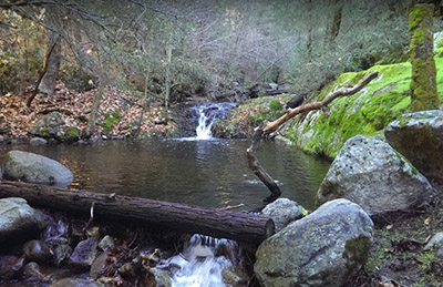
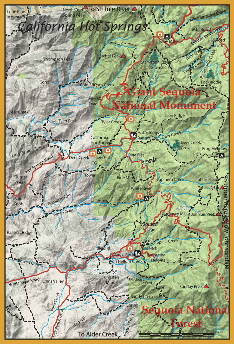
Directions:  Access to the California Hot Springs area and Deer Creek is by Mtn Road 56 (Hot Springs Road) from Ducor. Ducor is along Hwy 65 just south of Porterville. Mtn Road 56 ends at the intersection of Parker Pass Road (Mtn Road 50) and Pine Flat Road. Parker Pass Road goes through Parker Pass to an intersection with the Great Western Divide Highway. Mtn Road 50 continues east to Johnsondale. | ||
|
| ||
|
Notes:
| ||
Fishing Regulations (Effective March 1st, 2021)Local Rivers and Streams within Giant Sequoia National Monument and Sequoia National Forest: From the last Saturday in April through November 15, 5 trout daily bag limit, 10 trout in possession; and, from November 16 through the Friday preceding the last Saturday in April, 0 trout bag limit, artificial lures with barbless hooks only and trout must be released unharmed and not removed from the water. Local Rivers and Streams west of Giant Sequoia National Monument and Sequoia National Forest: From the last Saturday in April through November 15, 5 trout daily bag limit, 10 trout in possession; and, from November 16 through the Friday preceding the last Saturday in April, 0 trout bag limit, artificial lures with barbless hooks only and trout must be released unharmed and not removed from the water. All other Lakes: Open all year. No restrictions. 5 trout per day. 10 trout in possession.
| ||
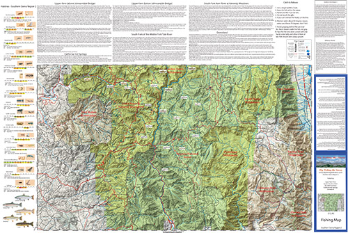
Fishing Map AvailableSouthern Sierra Region 2 covers the South Fork of the Middle Fork Tule River, California Hot Springs, Upper Kern River from Kernville to Kern Flat, South Fork Kern through Kennedy Meadows and Domeland Wilderness. Shows topographic relief, GPS Long./Lat., camping areas, road access, and trailheads. Special Features are Fishing Season and Regulations, Fish Identification, Catch & Release Procedures, and Stream Etiquette guidelines. |
|
$12.95 ea |
|